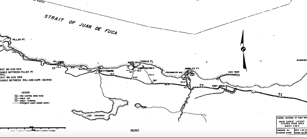
The bunkers at Camp Hayden (AKA Salt Creek Recreation Area) were the coolest and most easily accessible bunkers we would find. Our attempts to find other bunkers along the coast were made difficult by private land and lack of roads. We compared 1944 maps of the bunker locations to google maps to find the most probable location. Here’s a breakdown of what we found out:
The Angeles Point bunker is now a police station/justice center located on the Lower Elwha Klallam reservation.


The Agate Rock bunker is on DNR land but well off the main road, the closest we could get in our vehicle was within the private community of Port Crescent which had very imposing ‘NO TRESPASSING’ signs. We were unable to park our vehicle close enough to hike in. Port Crescent is a very pretty community with freshly painted roads and a pristine white sand beach. Unfortunately it is also very private. The roads to Agate Point were completely gated off, and they charge a daily fee to use the beach and enforce it with wristbands. We drove through the main road multiple times hoping to find a place to park but it was all private property so we left without finding the Agate Rock bunker.
A bunker we did actually find is the Majestic bunker! A long way down a muddy logging road on DNR land we found a clearing and walked around the perimeter. At first we walked past the Majestic bunker without realizing because it was so overgrown. I wonder how many people have been here and walked right by the black entrance in the trees. There was just as much graffiti on this one as the bunkers at Camp Hayden though, so it’s probably not as much of a secret as I’m imagining.

Entrance to Majestic 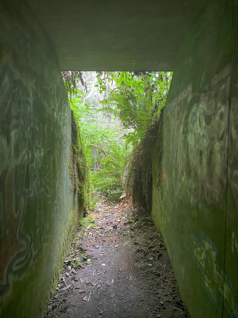
Looking out from inside the bunker

Inside the bunker 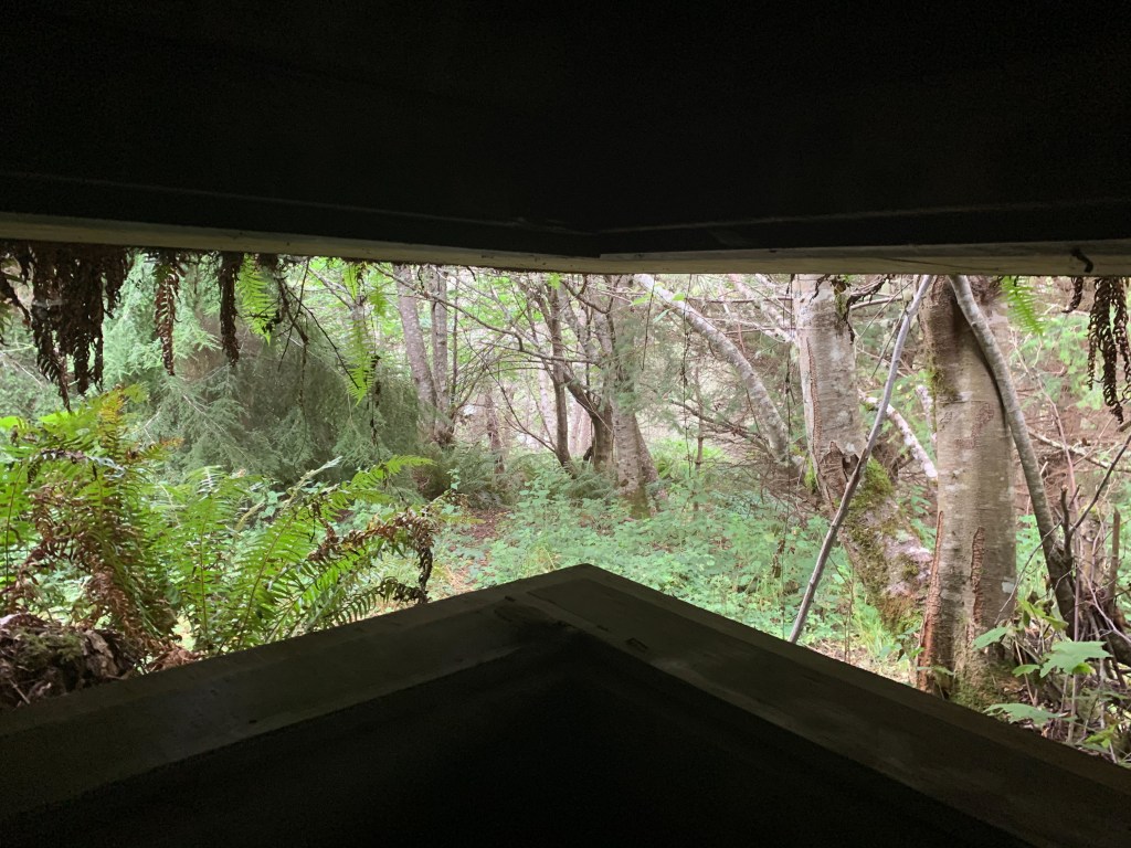
What was this window observing?
After the Majestic bunker we unfortunately could not find the remaining bunkers. Twin was the most difficult, we drove around a maze of logging roads but it’s hard to say how close we were to the location. The elevation has obviously changed a lot since 1944 because of the logging operations, and the road we were driving on doesn’t even exist on google maps. The bunker may have been far into the woods or perhaps the logging companies got rid of it.
We did notice that the company doing the logging in the Twin area is the same company that gated off entrance to Pillar Point, the next bunker along the coast. We were thwarted by yet another gated road with intimidating “ABSOLUTELY NO TRESPASSING’ signs at the entrance to Pillar Point (the real Pillar Point not the recreation area). The tree farm is Merrill & Ring, who have owned the land there since 1886 according to their website. We may contact them asking what happened to the WW2 bunkers on their land.
After Pillar Point we made a last ditch effort to drive to the only other bunker I’ve marked on google maps, near Cape Flattery. Unfortunately due to COVID-19 the road to Neah Bay is blocked off to visitors and we had to make a U-turn.
We stopped in Sekiu for hot chocolate when the weather turned cold and rainy. Not the best weather for bunker spelunking but the Juan de Fuca was still pretty in the rain.


At the end of our trip we had only found a few bunkers. We know the location of a couple possible-but-difficult ones and may come back prepared to do a lot more hiking, probably when COVID-19 ends so we can visit Cape Flattery too. We had a lot of fun searching for bunkers with WW2 maps and learned quite a bit about the area’s history.
More reading:
http://fortwiki.com/Striped_Peak_Military_Reservation This website goes into detail about the batteries and gun placements
https://60tripskayakpugetsound.blogspot.com/search/label/abandoned%20bunkers This blog searched for the same bunkers and links the WW2 maps we used
https://books.google.com/books?id=rpupDgAAQBAJ&pg=PT30&source=gbs_selected_pages&cad=3#v=onepage&q&f=false This Google book talks about the Field of Fire, and Batteries 131 and 249 from our last post


Leave a comment